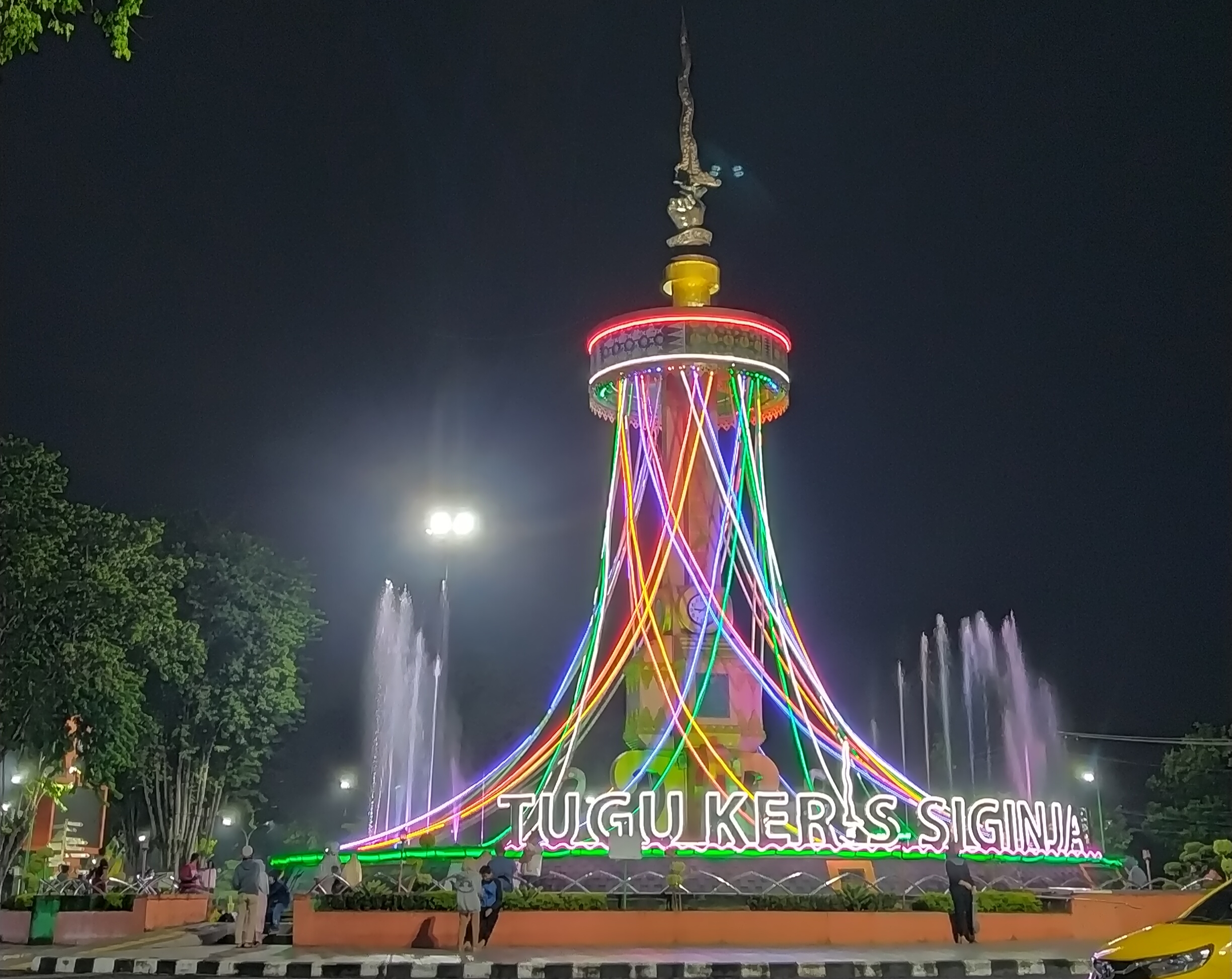
IDENTITY
A Jambi City icon
A keris-shaped landmark in the Kota Baru district.
 Tugu KerisJambi City guide
JAMBI CITY · INDONESIA
A civic landmark carrying the memory of Jambi’s heirloom—first seen from a distance, then understood through form, light, and the story it represents.
Tugu Keris Siginjai stands in Kota Baru, near Jambi City’s administrative district. Its form draws on Keris Siginjai, an heirloom associated in Jambi City Government’s emblem explanation with Jambi’s dignity and heroism.
The open space around it changes with the city’s rhythm: a point of orientation, a photographic backdrop, a meeting point, and at times part of a public programme. This guide helps you read the place while planning a measured visit.
Read Jambi City’s emblem explanation ↗IDENTITY
A keris-shaped landmark in the Kota Baru district.
MEANING
A symbol of dignity and heroism in the city’s emblem explanation.
MAP RATING
A third-party map-service score that may change.
COST
Current access rules and charges are not verified; confirm local arrangements.
SI GINJAI / HEIRLOOM
02 / MEANING IN FORM
Jambi City Government’s emblem explanation links Keris Siginjai to the dignity and heroism of Jambi’s former rulers. This explains the city symbol; it does not establish a number of sculpture levels or the monument’s dimensions.
The monument is not the heirloom itself. It is the city-scale translation of cultural memory into public space—a way to recognise Jambi as you enter Kota Baru.
03 / VISIT
The monument works best as a short stop connected with another Jambi City plan. It is an open urban space rather than a museum with a fixed visitor route.
A / TIMING
Plan around weather and road conditions. Use permitted public viewing areas; this guide’s night photograph does not establish the same lighting or access for your visit.
B / DURATION
This allows time to see the monument, take photographs, read a brief overview, and observe the district. Add time if you arrive during a public event or combine the stop with another destination.
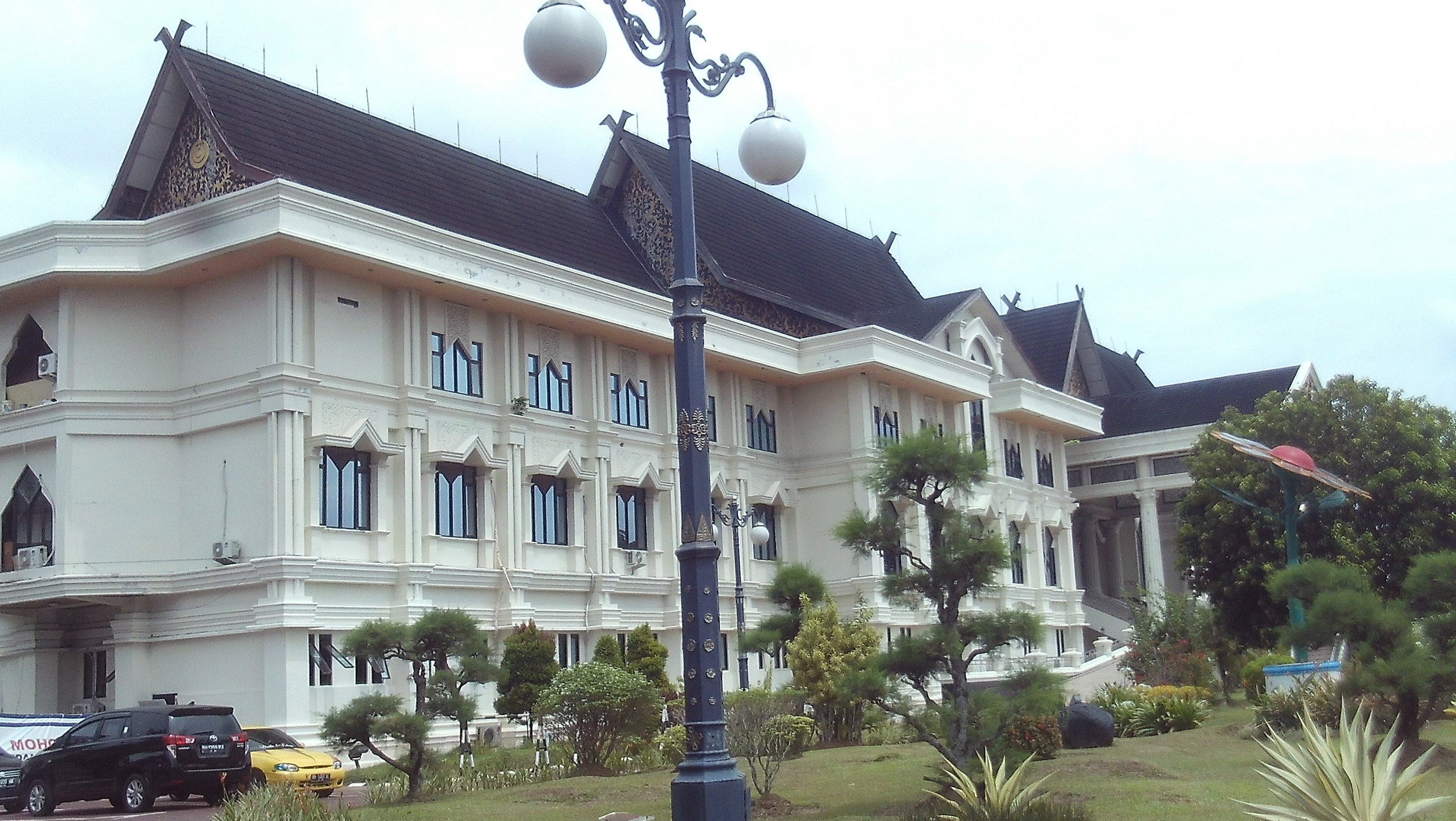
C / DISTRICT
The monument sits in an administrative setting; be aware of access, events, and local vehicle flow.
04 / ACCESS & ORIENTATION
Use “Monument of Keris Siginjai Jambi” or the Paal Lima, Kota Baru address as your destination. Travel times, routes, and road capacity can change.
The most direct options are an airport taxi, a rental vehicle, or a ride-hailing service. City buses have served the airport area; confirm active routes and schedules before relying on them.
Choose an active stop or route toward Kota Baru, then confirm an appropriate drop-off and permitted pedestrian route; do not assume access to a road island. Check route information on the day you travel.
Enter the monument name or its coordinates as the destination. This can help when a driver knows the city hall district better than the map address.
Follow road markings, staff directions, and temporary traffic measures when events are happening. Do not rely on roadside shoulders as parking; capacity can change quickly at night and on weekends.
ParkingLook for official areas and follow on-site signs.
ToiletsConfirm availability when you arrive.
Food & drinkChoose an appropriate type of venue nearby; no brand endorsements.
Everyday suppliesFind a convenience store or market according to your needs.
Fuel & chargingPlan before entering peak traffic periods.
05 / AROUND THE CITY
This is not a shopping list or a business recommendation. Use it as a set of categories and directions for building your own route.
To understand the keris and regional history, look for museums or cultural exhibition spaces run by public institutions. Check opening hours before travelling.
Public spaces along the river offer another way to read Jambi. Choose a safe area, follow local guidance, and be mindful of weather conditions.
In central Jambi, look for Melayu-Jambi restaurants, coffee shops, or simple meals according to your dietary needs and schedule; this guide does not endorse individual businesses.
If you have more time, research Jambi’s cultural and natural destinations separately. Distances and road conditions differ from a short visit in the city centre.
06 / LOCATION
Map address: 9J95+Q4F, Paal Lima, Kecamatan Kota Baru, Jambi City, Jambi 36129. Use the map to assess routing conditions from your current position.
Open in Google Maps ↗07 / FAQ
These answers are for initial orientation. For event changes, access, or public services, check Jambi City’s official channels shortly before your journey.
Current access rules and visitor charges have not been verified. Check official notices and staff directions around events; this independent guide does not sell tickets or guarantee free access.
Consider weather, daylight and road conditions on your visit day. View the monument only from permitted public areas; do not assume night lighting, access to a road island or a crossing is always available.
Consider an airport taxi, rental vehicle, or ride-hailing service from Sultan Thaha Airport. For buses and local transport, confirm current routes and operating hours on the day you travel.
Parking and toilet availability can change with district arrangements. For food or supplies, use nearby venue categories as an orientation and choose independently according to your needs.
Google Maps did not display opening hours when checked on 19 October 2026. This does not mean 24-hour access. Confirm local access and arrangements before travelling.
08 / TRANSPARENCY
Symbolic context refers to Jambi City Government’s emblem explanation; linked event reports are dated accounts, not recurring schedules. Map scores, routes, and service conditions may change; use this site as a starting point rather than a substitute for a pre-travel confirmation.
09 / THEMATIC GUIDES
Standalone pages answering traveller needs: history, access, food, and routes. All non-profit and source-referenced.